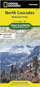
• Waterproof • Tear-Resistant • Topographic Map
Explore the alpine forests, wild rivers, jagged peaks, and abundant glaciers of North Cascades National Park with National Geographic's Trails Illustrated map. Expertly researched and created in partnership with local land management agencies, this map features key points of interest including Baker Lake; Rockport State Park; Chelan and Ross Lake National Recreation Areas; Stephen Mather, Mount Baker, and Pasayten Wilderness Areas; Snoqualmie and Okanogan Wenatchee National Forests; and portions of the Sauk, Skagit, and Suiattle rivers.
With miles of clearly marked trails including the popular Pacific Crest and Pacific Northwest trails, this map can guide you off the beaten path and back again. Mileages between intersections are shown and the map base includes contour lines and elevations for summits. Helpful material about backcountry use, regulations, recreation activities, and agency contact information will assist you in making the most of your visit. Recreation features noted include alpine ski areas, rental cabins, lookout towers, campgrounds, interpretive trails, boat launches, fishing access, and more.
Every Trails Illustrated map is printed on "Backcountry Tough" waterproof, tear-resistant paper. A full UTM grid is printed on the map to aid with GPS navigation.
Other features found on this map include: Bacon Peak, Baker Lake, Bonanza Peak, Glacier Peak Wilderness, Hidden Lake Peaks, Lake Chelan-Sawtooth Wilderness, Lake Shannon, Miners Ridge, Mount Baker, Mount Baker Wilderness, Mount Buckindy, Mount Challenger, Mount Lago, Mount Logan, Mount Shuksan, Mount Spickard, Mt. Baker National Forest, Noisy-Diobsud Wilderness, North Cascades, Okanogan National Forest, Pasayten Wilderness, Picket Range, Ross Lake, Sauk River, Snowking Mountain, Suiattle River, Twin Sisters Mountain, Wenatchee National Forest.
- Map Scale = 1:100,000
- Sheet Size = 25.5" x 37.75"
- Folded Size = 4.25" x 9.25"
![Grand Canyon West [Grand Canyon National Park] (National Geographic Trails Illustrated Map) (National Geographic Trails Illustrated Map, 263)](https://images-na.ssl-images-amazon.com/images/I/51sW7+IKcgS._SX228_BO1,204,203,200_.jpg)
![Mogollon Rim, Munds Mountain [Apache-Sitgreaves, Coconino, and Tonto National Forests] (National Geographic Trails Illustrated Map, 855)](https://images-na.ssl-images-amazon.com/images/I/51YuAk0rUmL._SX228_BO1,204,203,200_.jpg)
![Tonto National Forest [Map Pack Bundle] (National Geographic Trails Illustrated Map)](https://images-na.ssl-images-amazon.com/images/I/512U4aGOieL._SX220_BO1,204,203,200_.jpg)
Reviews (33)

Be aware: Disney ownership, unrevised maps with 2019 copyrights
I purchased the 2006 copy of this map from Amazon a number of years ago. Recently I saw this same map for sale at another source with a 2019 copyright, and thinking that it would be an updated edition, I bought it. However, when comparing both editions, I found no changes in the cartographic data. The only change was some limited text revision (apparently to qualify for a more recent copyright date). What's going on? It turns out that the Trails Illustrated maps are no longer published by the National Geographic Society. Rather they are published by a business corporation named "National Geographic Partners", which is 73% owned by The Walt Disney Company. Many of the maps have been reprinted with a 2019 copyright date (and a 25% price increase), but these are not necessarily recent revisions. I have found other titles with a 2019 copyright but no revisions in cartographic data from earlier editions. It seems that Amazon has caught on to this, as the earlier true revision dates are being listed for these maps (in this case, 2006). So if you see a Trails Illustrated title listed elsewhere with a 2019 date, and the edition listed in Amazon is older, the Amazon listing is likely showing the actual revision date. The ISBN cannot be relied on to distinguish editions for maps and atlases, as publishers will often retain the same ISBN even when publishing updated editions.

Not as detailed as I expected
This map is not as detailed as I expected. For backpacking trips planning you are better off using a map published on NPS website along with topo map published topozone website. For example, two campsites by Trapper Lake are not shown at all. I think, this map is okay to take with you on the trail, but, I think, Nat Geo should have broken this map into a set of maps and made it more detailed topo map.

Great Map
Can't go wrong purchasing a map from National Geographic. Notice at the bottom of the photo: "Waterproof and Tear Resistant" This is a topographical map with all the information for a great outdoor adventure.

Don't go without this map
North Cascades is very intimidating, topographically. I would never consider hiking off-trail in this location without a detailed map like this. Helped orient us and provided great detail on recent vacation.

Great Map, only want more elevation readings
Worked out really well for backpacking the northwest ridge loop in north cascades. Would only ask they add more elevation marks for more things likes passes and campsites. Calculating elevation from topo lines can be very tedious and inaccurate.

A great map for hikers
This a great map for those who choose to travel the forest roads throughout the North Cascades NP. My wife and I depend on it to keep us from getting lost in the maze of first roads throughout the area. I definitely recommend it to people wanting to find hiking trails way off the beaten path!

... that I am planning on traveling to and I love them. They help me to find hiking locations ...
I get these National Geographic maps for any location that I am planning on traveling to and I love them. They help me to find hiking locations and sights that I may want to visit.

Good map
The map withstands moisture quite well. Could be a bit more descriptive as a few trails were excluded.

National Geo ! the best
great product, sturdy and accurate

value
Will be used while visiting the park.

Five Stars
Best maps

Map of North Cascades National Park
The National Geographic Map of North Cascades National Park is superb. It covers the adjacent national forests and wilderness areas. Very easy to spot excellent hiking possibilities, both challenging and easy.

Five Stars
great

Not The Real Thing
It came with a suspicious red substance on it. The map doesn’t even look correct. I believe this is a knockoff.

Details
Item was as advertised

Five Stars
love these maps.... haven't found a way to damage one yet.

Five Stars
Great high quality map. Could show more detail.

Its a map!
cant wait to start looking for new places to camp.

Great detail
All you need to plan out a great trip in the North Cascades. Waterproof paper, good scale, and distance markers.

Five Stars
Great quality. Won't fall apart like a paper map.

It shows me where certain land features are on a ...
It shows me where certain land features are on a portable medium. This is exactly what I was looking for.

Five Stars
very nice

Great map
I love maps and these provide great detail and info. They're also very beautiful to look at, works of art.


