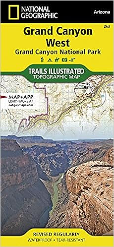
• Waterproof • Tear-Resistant • Topographic Map
National Geographic's Trails Illustrated map of Grand Canyon West covers some of the less frequented but just as wondrous landscape of Grand Canyon National Park, from Powell Plateau to the park's western boundary. Expertly researched and created in partnership with the National Park Service, U.S. Forest Service, Bureau of Land Management and others, the map also covers the surrounding areas of Kaibab National Forest, Hualapai Havasupai Indian Reservations and Parashant National Monument. With so much of the area being backcountry, the map also includes useful backcountry information, regulations and safety tips, in addition to a backcountry use area guide, color-coded by degree of experience required.
Clearly marked trails, including unmaintained primitive trails, will guide you around the area, whether you're traveling by foot, horse, mountain bike, or motorized vehicle. The map base includes contour lines and elevations for summits, and river mileage is noted for the Colorado River. Backcountry zones within the park are marked with their boundaries and labeled with their National Park Service code. Some of the many recreation features include campgrounds and campsites, boat launches, ATV trails, scenic viewpoints, and interpretive trails.
Every Trails Illustrated map is printed on "Backcountry Tough" waterproof, tear-resistant paper. A full UTM grid is printed on the map to aid with GPS navigation.
Other features found on this map include: Aubrey Cliffs, Grand Canyon, Grand Canyon National Park, Grand Wash Cliffs, Granite Gorge, Kaibab National Forest, Kanab Creek, Kanab Creek Wilderness, Kanab Plateau, Lake Mead National Recreation Area, Lower Granite Gorge, Mount Dellenbaugh, Parashant Canyon, Peach Springs Canyon, Sanup Plateau.
- Map Scale = 1:90,000
- Sheet Size = 37.75" x 25.5"
- Folded Size = 4.25" x 9.25"
![Mogollon Rim, Munds Mountain [Apache-Sitgreaves, Coconino, and Tonto National Forests] (National Geographic Trails Illustrated Map, 855)](https://images-na.ssl-images-amazon.com/images/I/51YuAk0rUmL._SX228_BO1,204,203,200_.jpg)
![Tonto National Forest [Map Pack Bundle] (National Geographic Trails Illustrated Map)](https://images-na.ssl-images-amazon.com/images/I/512U4aGOieL._SX220_BO1,204,203,200_.jpg)
Reviews (18)

maps
These are the best maps for detail, size, and usage. Go nowhere without these.

Good backpacking map
I am an experienced backpacker in the Grand Canyon, and I decided it would be good to get a new map. One thing that is different from the previous Nat Geo maps is that the Grand Canyon is broken into 2 separate maps, this one and Grand Canyon East #262. One huge advantage to having 2 maps is that the western Grand Canyon is shown the whole way to Lake Mead. This means that the following trails are now shown: the Kanab Creek Trail (including many of the access trails north of Kanab Creek), the Tuckup Trail and Route, the Lava Falls Trail, Whitmore Trail, Parashant Canyon Route, and other rim trails. The only negative to having 2 maps is just that, you have to carry 2 maps. Other than that, the map provides a bunch of information about hiking in the canyon, getting permits, etc. I would recommend this to any Grand Canyon hiker.

Great tool for planning
Great mao though the transition from one side to the other is in a bit of an inconvenient place for me.

GC West map
Used for planning trip so haven't taken it into the field yet. I used it in conjunction with USGS 7.5' quads which are still the most detailed for terrain. The Nat Geog map is very useful for having permit zones and a wider area.

The scale is smaller than I like, but it covers large areas of the Grand ...
The scale is smaller than I like, but it covers large areas of the Grand Canyon that are less familiar.

It is great!
Just what I wanted!

Great trail map
Sufficiently provided the trails we were looking for.

Five Stars
Nice map.

some description like the Grand Canyon map I have for the national ...
Meh. Was really looking for much more information about Havasupai trail on this one, i.e.: distance, rating, some description like the Grand Canyon map I have for the national park. But it's woefully devoid of such detail.


